

Hurricane Irene made landfall this morning near Cape Lookout, North Carolina, as a Category 1 hurricane with maximum sustained winds estimated at 85 mph.
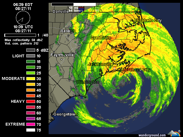
There is some indication on satellite and radar that Irene may actually be getting slightly better organized at this hour — the Outer Banks don’t provide much real land interaction, and the hurricane is still drawing plenty of moisture from the Atlantic, so that’s possible — but I’ll believe it when it’s verified. There have been a ton of false alarms over the last few days with this storm seemingly trying to get organized, so I’m not going to jump at every radar or satellite blip that suggests “tightening” or intensification. In any event, it’s hard to see Irene getting significantly stronger at this point. If she’s tightening, maybe she’ll hold together as a minimal hurricane through landfall in Long Island, instead of weakening to a strong tropical storm. That’s probably the realistic worst case at this point.
Regardless, the general parameters of this situation seem quite clear, and basically unchanged since yesterday. Wind damage will occur, particularly with trees and branches, but the winds will not be catastrophic by any means. In terms of wind, this may feel to a lot of folks like a strong Nor’easter. Power outages will likely be widespread. Inland flooding will be a big, big deal — if there are deaths in this hurricane, aside from the odd Darwin Award-winning surfer or beachgoer, that’s where they’re likely to come from. The severity of the storm surge is the big open question; we’ll see. (Watch the tidal gauges.) Residents in low-lying areas in evacuation zones should continue to assume the (realistic) worst, and should already be out or rapidly getting the Hell out. Bottom line, Irene is a big storm to be taken seriously, and it will cause a stormy weekend and plenty of damage, but this is by no means the worst-case scenario for NYC and the northeast — and to the extent the media or government is pretending otherwise, they need to ramp down the hype, for the sake of avoiding complacency about the next storm. Fear of a calamity was fully justified 24-36 hours ago, but we can now be quite confident this won’t be a world-historical disaster… even while being equally confident that it is a force to be reckoned with, and one residents should not blow off. Surely there must be some way to communicate both of these concepts simultaneously.


Join the conversation as a VIP Member