
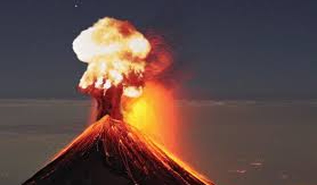
WASHINGTON – An expert volcanologist and geochemist told Congress this week that efforts to predict potential volcanic eruptions are being hampered by outdated equipment and lack of funding.
The United States Geological Survey’s (USGS) Volcano Hazards Program has designated 55 volcanoes in the U.S. as serious threats. Of these volcanoes, 18 are deemed “very high threats” because an eruption occurring at any of these could cause significant air travel disruptions and threaten people’s lives.
Ten of the 18 volcanoes in the U.S. that have been identified as very high threats lie on the Cascade Range, which stretches from British Columbia to northern California.
Eruptions from the Cascade Range volcanoes not only directly affect the states of Oregon, Washington, and California, but volcanic activity from this area can also affect nearby states, such as Idaho, Montana, and Nevada.
The Volcano Hazards Program received $15 million in funding through the 2009 American Reinvestment and Recovery Act’s stimulus funding package. Congress has failed to authorize funding for the program, which has survived using money from the USGS’ general budget, since 2011.
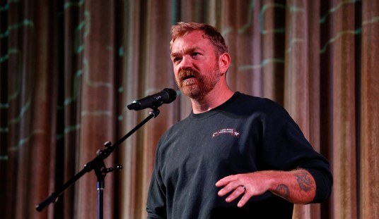
Rep. Doug Lamborn (R-Colo.), chairman of the House Natural Resources subcommittee on energy and mineral resources, said the program has “too long gone” unauthorized by Congress.
“Many of these high-threat volcanoes in the Pacific Northwest don’t yet have the adequate instrumentation in place to properly monitor their status,” Lamborn said.
Charles Mandeville, Volcano Hazards Program coordinator for USGS, said there is no quick solution for the nation’s volcano “monitoring gap.” He said it would take USGS between 10 and 15 years to update the instruments monitoring a single volcano, but it will take “a good 20 years” under the current budget.
“If our current budget stays at this level, it will take much longer for the simple reason that we’re in the process of repairing networks that have been subjected to deferment in the past few years,” Mandeville said. “To make significant strides in closing the monitoring gaps at some of our volcanoes we would need additional resources.”
Each USGS observatory monitors activity and issues forecasts and warnings. They also conduct investigations to determine the hazards posed by each volcano and maintain an extensive communication program to inform the public of any volcanic threats in their backyard.
In addition, the USGS regularly maps hazards from naturally occurring quakes, warning building engineers and local governments to the probability of moderate and strong shaking in their regions based on fault lines and seismic studies.
Five volcano observatories comprise the National Volcano Early Warning System (NVEWS) – a nationwide effort to monitor the most dangerous volcanoes. A USGS priority since 2005, progress on the warning system has stalled because of budget cuts.
“The USGS is about 30 percent complete toward its NVEWS goal of monitoring all hazardous volcanoes in the U.S. at levels commensurate with the threats they pose,” Mandeville said. Many high-threat volcanoes “have only rudimentary monitoring that works at this time.”
He said the USGS needs up to $2 million per high-threat volcano to adequately provide needed instrumentation to monitor it.
“We can’t prevent volcanoes from erupting,” Mandeville said. “However, research and monitoring can make communities across the nation safer and stronger.
Mandeville said the most widespread hazard from explosive eruptions is volcanic ash and ash clouds that can affect communities and air space hundreds to thousands of miles away from the source.
Hawaii’s Kilauea volcano, which has been spewing lava for more than 30 years, has caused the evacuation of Pahoa, a town of close to 1,000 on Hawaii’s Big Island.
Local scientists and officials have been tracking the slow-moving lava since late June, when the molten rock began to surface from a recently developed vent in the active volcano.
The flow has advanced an average of 174 yards per day. The lava destroyed its first structure earlier this month and is currently flowing toward a major road that would affect more than 10,000 people if it continues on its path.
Darryl Oliveira, director of Hawaii County Civil Defense, praised the USGS role in monitoring volcanic activity and said that without the agency’s assistance the situation on the Big Island could be much worse.
“They provide a tremendous service to our community and an invaluable service to our department,” Oliveira told the panel via a conference call from Hawaii.
The world’s largest volcano, Mauna Loa, and one of the most active volcanoes, Kilauea, are both in Hawaii.
There have been three major eruptions in the U.S. in the past 100 years: the 1914-1917 eruption of Lassen Peak in California and the 1980-1986 and 2004-08 eruptions of Mount St. Helens in Washington state.
In all, there are 169 potentially active volcanoes in the U.S. About 35 percent of them have erupted in the last 200 years.


Join the conversation as a VIP Member