

Might Tropical Storm Chantal miss altogether its expected fateful encounter with Hispaniola, which was supposed to determine its fate? The latest computer models suggest maybe so:
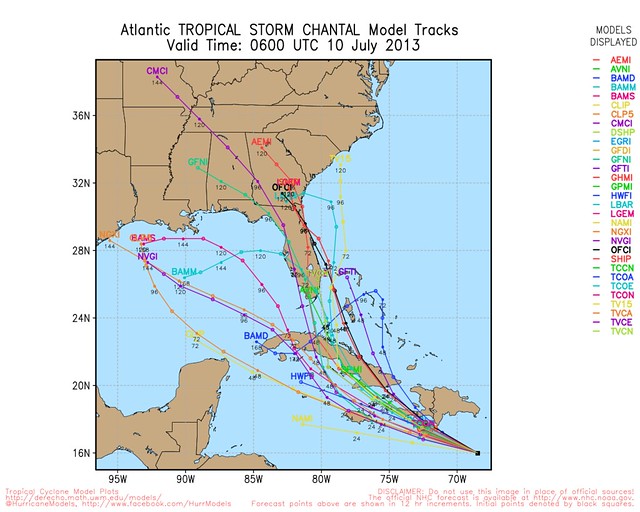
John Morales, chief meteorologist at NBC’s Miami affiliate, discussed this possibility earlier Tuesday night: “How do you stop the #Chantal train? Moving at 26mph it’d be hard for it to turn sharply NW. If it misses Hispaniola, all bets are off.”
By saying “all bets are off,” Morales was referring to the forecast for weakening or even dissipation caused by a direct hit on mountainous Hispaniola. Squeezing between eastern Cuba and Jamaica would be an entirely different scenario — although Morales was quick to add: “it should also be pointed out that #Chantal’s survival isn’t entirely up to Hispaniola’s mountains. It will encounter shear.”
Morales then RT’d this tweet by David Bernard, the Chief Meteorologist at CBS’s Miami affiliate, showing that shear:
Shear of death. #Chantal pic.twitter.com/Gwj1k2ONmD
— David Bernard (@DavidBernardTV) July 10, 2013
Meanwhile, models and forecasts aside, the simple fact is that right now, Chantal is looking ragged and disorganized. Its winds are down to 50 mph, and its forward speed is up to a remarkable 30 mph.
#Chantal doesn't look so good. pic.twitter.com/DbJiGX9Qam
— Ryan Maue (@RyanMaue) July 10, 2013
Stay tuned, as they say. I’ll keep updating Chantal here on Weather Nerd for as long as the storm remains a potential threat to the U.S. coastline. For even more frequent updates, follow me on Twitter (@brendanloy). Another good resource for the latest information is Amy Sweezey’s “Wx Tweeps” Twitter list.


Join the conversation as a VIP Member