NOAA's scientists at the Climate Prediction Center now give El Niño an 82% chance of developing between May and June 2026. The same forecast gives the warm phase a 96% chance of lasting through the Northern Hemisphere winter of 2026 and 2027.
Some model runs now point toward a strong event, with a few hints that the pattern could rank among the more intense episodes on record. Translation for us normies: the Pacific is shifting, the weather will follow, and the climate panicans will soon start throwing sparks.
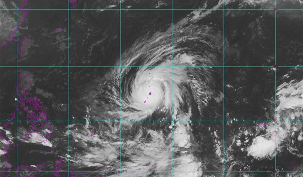
El Niño forms when unusually warm water builds in the central and eastern tropical Pacific. Winds change, rain belts move, jet streams bend, and weather patterns ripple across continents like a shove down a long table. From Phys.org:
This occasional anomalous warm ocean current in the Pacific was originally noted by 19th-century Peruvian fishermen. They called it El Niño—"the child" in Spanish—because it often arrived around Christmas time.
It occurred when warm waters from the equatorial Pacific replaced the usual cold waters off the coasts of Ecuador (south of the city of Guayaquil), Peru and northern Chile. These waters are normally quite cold due to the Humboldt Current—which flows from south to north along this section of South America's coastline—and due to the upwelling of deep cold waters.
The impact of these currents is significant. Take, for instance, the Chilean city of Antofagasta on the Pacific coast, and Rio de Janeiro on the Atlantic coast. They are at almost exactly the same latitude, the Tropic of Capricorn, but their average sea temperatures are very different: around 18°C in Antofagasta and 24°C in Rio de Janeiro.
For Peruvian fishermen, the arrival of the warmer El Niño current meant the disappearance of their most abundant and prized fish, the anchoveta, which thrives in cold, plankton-rich waters.
I'm willing to bet that those of us pushing at least age 60 had fathers who were true Renaissance men, who would build, wire, and plumb entire buildings and had an innate mechanical knowledge.
Full disclosure: that skill landed on my brother, not me. I know enough when to stop at my limits, but my brother is truly gifted.
Anyway, my dad taught me about El Niño in the early 1980s, and his knowledge was backed up: scientists have tracked those swings for decades with ocean buoys, satellites, ship observations, and weather stations. The cycle moves between El Niño and La Niña and neutral phases on no fixed calendar, but the fingerprints remain familiar enough for farmers, shippers, emergency managers, and forecasters to plan around them. Again from Phys.org:
In the 1920s, British physicist and climatologist Gilbert Walker made a surprising discovery. While analyzing vast amounts of atmospheric pressure data, he realized that when pressure increased in the South American Pacific, it decreased in northern Australia and Indonesia, and vice versa. In other words, these two regions of the planet, thousands of kilometers apart, were connected in terms of atmospheric pressure behavior. This is what we now call a teleconnection, a long-distance meteorological link.
This coordinated oscillation in atmospheric pressure across the South Pacific was named the Southern Oscillation. But what does El Niño, an ocean current, have to do with the Southern Oscillation, an atmospheric phenomenon?
As well as having a negative impact on the Peruvian fishing industry, El Niño brings rainfall—sometimes torrential—to the arid regions of Peru and northern Chile, home to the world's driest desert, the Atacama. In 1957-1958, a very intense El Niño caused torrential rainfall in Peru and other countries, and a severe drought in India and Southeast Asia, spurring further research into the phenomenon.
Strong El Niños have left a long paper trail. The 1997 and 1998 events brought heavy rain and flooding to California and parts of the southern United States while drought hit Australia, Southeast Asia, and northeast Brazil. The 1982 and 1983 events hammered Peru and Ecuador with destructive rains while dry conditions strained India, Indonesia, and other regions. The 1957 and 1958 events produced many of the same broad effects. Global average temperatures rose for a time, then eased after the Pacific released its stored heat, and the cycle moved on.
The World Meteorological Organization puts the odds of El Niño near 80% for June through August and near or above 90% through November. Its forecast points to the same basic risks: heavier rains in parts of the southern United States, South America, and East Africa, along with drought pressure in Australia, Southeast Asia, and northeast Brazil. Those outcomes don't need a fresh political sermon; they match the old pattern well enough to make preparation practical and panic unnecessary.
Daniel Swain, a climate scientist at the University of California, Los Angeles, has often described El Niño as a pattern that loads the dice for certain weather extremes. The phrase works because it doesn't pretend the dice appeared last week.
El Niño belongs to the natural ocean-atmosphere system. It can raise global temperatures for a period because stored ocean heat moves into the atmosphere; it can worsen storms or droughts in certain regions, but it can also fade, reverse, and give way to La Niña, as the record has repeatedly shown.
Climate activists will almost certainly treat any temperature bump as proof that global warming has returned with a vengeance. The script rarely changes; a warm spike becomes a moral indictment, a storm becomes a lecture, and a drought becomes a fundraising email.
Lost in the performance is the basic scientific point: El Niño has caused short-term warming spikes long before the latest political vocabulary arrived. Human influence on climate can remain a subject for serious measurement, but El Niño doesn't need activists to explain its existence.
Javier Martín Vide, professor of physical geography at the University of Barcelona, has noted that a strong El Niño can push global averages upward by a few tenths of a degree above the longer trend. The key mechanism comes from heat already stored in the ocean: a powerful El Niño doesn't create a brand-new planet overnight. It moves heat around, disrupts rainfall, shifts winds, and reminds mankind that oceans still hold enormous power over daily life.
Real science works because measurements keep disciplining the story. Buoys report sea surface temperatures; satellites track clouds, water vapor, and ocean height. Forecasters compare fresh readings with past events and adjust the outlook when the numbers change.
Nobody needs to pretend certainty where uncertainty remains. Nobody needs to dress every weather swing in apocalyptic language, either. El Niño already gives planners enough to worry about without turning every chart into a political weapon.
Farmers will watch rainfall, ports will watch storm risk, and emergency managers will prepare for floods, droughts, heat, and fire conditions where history points them. The public deserves that kind of clear guidance. Hype helps nobody fill a sandbag, move cattle, protect crops, or plan water use.
The coming El Niño will raise temperatures for a while if the forecast holds. The Pacific will release heat, the atmosphere will respond, and many of the old regional patterns will return.
Afterward, the cycle will change again, because El Niño has always moved in chapters.
The honest task is to read the data without pretending every familiar page came from a brand-new book.