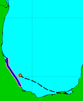
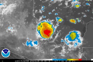
Tropical Storm Marco, the Lilliputian cyclone, continues to approach the Mexican coast, and is expected to make landfall in the Mexican state of Veracruz — probably right near Tecolutla, where Hurricane Dean came ashore last year — in a few hours. Marco’s tropical-storm-force wind field is a mere ten miles wide, so the exact location of landfall will make all the difference, and only a very narrow area will be affected.

The miniscule orange circle is Marco’s wind field.
Marco’s top sustained winds are estimated at 65 mph, but candidly, the NHC is basically just guessing on that. Their normal satellite-based intensity estimation tools are not working well with miniature Marco, so they’re essentially leaving the intensity at the amount revealed by yesterday’s reconnaissance mission, since the storm looks roughly the same as it did then.
What a weird storm.
Marco could still become a hurricane before landfall — although, with no additional recon missions scheduled, we may never know for certain whether it does, unless the storm’s tiny core happens to pass directly over an anemometer on the Mexican coast!


Join the conversation as a VIP Member