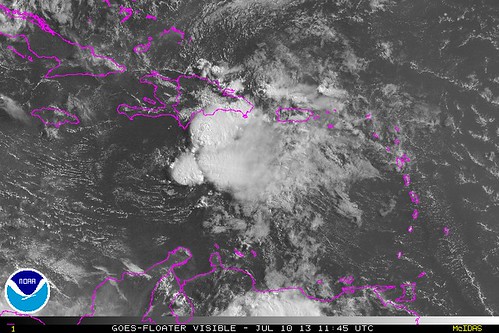
It appears that Tropical Storm Chantal, torn apart by wind shear and by her own rapid forward motion, has probably dissipated to a “tropical wave” — a disorganized collection of thunderstorms with no closed circulation. Here’s the current satellite view this morning:
The National Hurricane Center’s “intermediate” advisory at 8:00 AM Eastern Time (in between the full advisories, with detailed meteorological discussions, at 5am and 11am) said this:
…CHANTAL MOST LIKELY A TROPICAL WAVE…
…RECONNAISSANCE PLANE EN ROUTE TO VERIFY…
So, unless the reconnaissance plane finds something unexpected, it is likely that Chantal will be downgraded to a dissipated former tropical cyclone at 11:00 AM Eastern, if not sooner. Stay tuned. I’ll update Weather Nerd when I can, and in the mean time, follow me on Twitter (@brendanloy) for more frequent updates. Another good resource for the latest information is Amy Sweezey’s “Wx Tweeps” Twitter list.


Join the conversation as a VIP Member