
[NOTE: For the very latest on Irene, check my Twitter feed.]
* * * * *
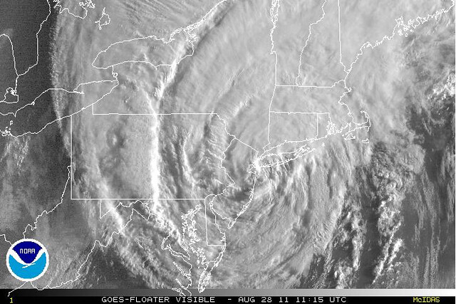
Hurricane Irene came ashore this morning over Coney Island, New York, weakening to a tropical storm as it did so. I’ll save any damage assessment until later, as early impressions are often wrong. But it’s safe to say that New York is very, very lucky Irene didn’t intensify into a Category 4 monster south of the Carolinas, as had been reasonably expected by forecasters before the storm’s inner core structure fell apart Wednesday/Thursday and unexpectedly never recovered. Irene’s track (and timing, in terms of high tide) ended up being pretty darn worst-case for highly vulnerable NYC, but thankfully, its intensity wasn’t. Hence, the storm surge peaked around 4 feet — bad enough to cause significant flooding, but seemingly not catastrophic — and the sustained winds probably topped out at high-end tropical storm force. Had this hurricane become a monster down south, it would have had a much bigger storm surge all throughout its life, and its winds would have had a long way to go in order to weaken to tropical storm force. It’s very plausible New York could have been hit by a Category 2 hurricane in that scenario, maybe even a low-end Category 3, and there’d be no discussion of “overhype.”
More later.
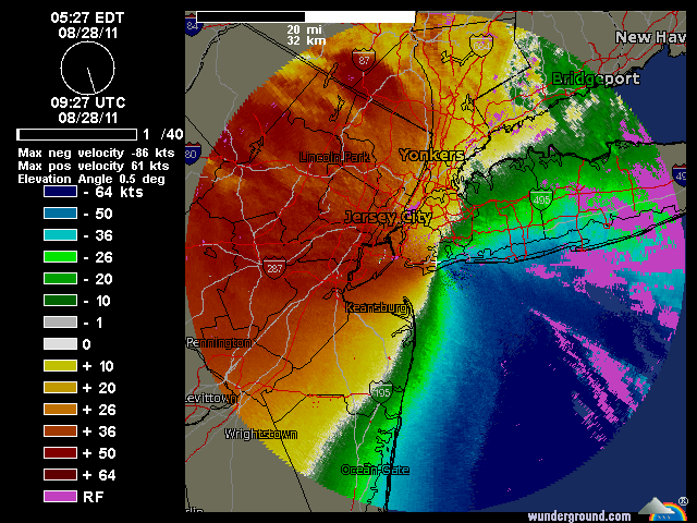
Above: Wind-velocity Doppler radar showing the wind direction shifting as Irene hit NYC.


Join the conversation as a VIP Member