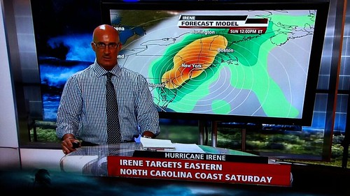
Quick late update here. The Weather Channel’s Jim Cantore says he had a pit in his stomach when he saw this computer-model forecast from the GFS earlier today:
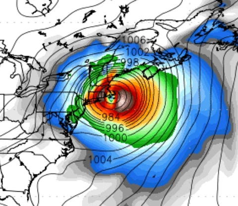
But now the late-night 0Z GFS computer model is out, and — guess what? — it shifts Irene’s landfall point to the east, again. Now the target landfall location has moved from NYC/Long Island to Cape Cod:
Actually, isn’t Martha’s Vineyard in the eye there? Is Mother Nature trying to tell President Obama something? Heh!
In all seriousness, again, the point isn’t the exact landfall point, which is subject to huge errors this far out. The point is the trend. The trend is your friend. And the rightward trend is continuing.
This hurricane may yet stay out to sea, folks. Cross your fingers.
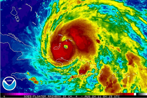
On a less reassuring note, Irene looks on satellite like she’s really getting her act together. Also, the barometric pressure has been dropping this evening. The winds often take time to “catch up” with the pressure, and that delay has been happening. But the winds will catch up very soon. I expect to wake up in the morning to a significantly strengthened storm, and I wouldn’t be surprised if it’s rapidly intensifying.


Join the conversation as a VIP Member